Table of Contents

Ans. (d) Aravalli is parallel to S.W. Monsoon wind
Explanation:
There is a mountain range in Rajasthan namely the Aravalli Hills but they stretch South-west to North-east direction. Thus, the Aravalli Hills are roughly parallel to the Arabian Sea Monsoon
Ans. (c) Inundation and perennial.
Explanation:
There are two types of Canal irrigation- Inundation Canal and Perennial Canals. Canal irrigation is the most important form of irrigation in India and It is cheaper.
Explanation:
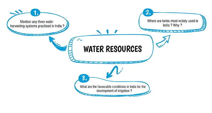
1. The simplest rainwater harvesting technique is ‘check’ dams. It is a small barrier built across streams. They store water during the monsoons which can then be used for irrigation and other things.
2. Another rainwater harvesting technique is the storage tank kept underground and connected to the pipe coming down from the roof. The rainwater enters the tank through a filter which removes leaves and other debris. The system contains a pump which pushes or sucks the rainwater back into the house which is then delivered to the garden and for washing clothes, etc.
3. Another rainwater collection system is the Garden Watersaver Diverter. It is a downspout rainwater diverter which simplifies the collection of rainwater. It has many advantages over other rainwater collection systems, that is, it instals in minutes and deactivates in seconds during winter when stored water isn’t much needed.
Explanation:
Tanks are mostly used in Peninsular India. This is because :
1. Peninsular India consists of hard impenetrable rocks which favour the storage of water.
2. Depressions in the plateau regions can be used as natural tanks.
Explanation:
(i) Perennial Rivers : There are a number of rivers which flow throughout the year because they are fed by the melting of snow.
(ii) Suitable spots for the construction of dams : Along the Indian streams there are many places suitable for construction of dams or embankments across the streams for impounding the water.
(iii) Inexhaustible store of underground water : A large proportion of the rain water finds its way underneath the surface by percolation and remains stored in the aquifer rock-layer. This underground water can be tapped for irrigation when required.
(iv) Arable land is level : Arable lands in India are confined to the northern plains and also parts of deltaic India which are level and suitable for the construction of canals.
(v) Abundance of natural depressions in Southern India : Peninsular India is mostly a plateau region with rolling uplands. There are a number of natural depressions. Only an earthen embankment is required to check the outflow.
Download Mind Map of this chapter
Download NowWant to Practice Mock Tests of this chapter
Practice NowDownload Important Questions of this chapter
Download Now| Chapter No. | Chapter Name |
|---|---|
| Chapter 1 | Map Study: Interpretation of Topographical Maps |
| Chapter 2 | Map of India |
| Chapter 3 | Location, Extent and Physical features |
| Chapter 4 | Climate of India |
| Chapter 5 | Soil Resources |
| Chapter 6 | Natural Vegetation of India |
| Chapter 7 | Water Resources |
| Chapter 8 | Mineral and Energy Resources |
| Chapter 9 | Agriculture In India |
| Chapter 10 | Industries in India: Agro Based |
| Chapter 11 | Industries in India: Mineral Based |
| Chapter 12 | Transport in India |
| Chapter 13 | Waste Generation and Management |
CBSE Important Questions Class 10
ICSE Important Questions Class 10
CBSE Important Questions Class 10
ICSE Important Questions Class 10