Map of India

Class 10 Geography Chapter 2
Map of India
Important Questions

Here are some class 10 Map of India important questions and answers .These questions aim to aid students in practising and achieving high scores in their ICSE Class 10 Geography Examination 2024-25. Diverse question types will assist in clarifying doubts and effective exam preparation, enhancing problem-solving skills, and building confidence. ICSE class 10 geography important questions will be helpful in scoring good marks and enhance the preparation for the exam.By practising class 10 Map of India important questions and answers students can identify areas where they are struggling. This allows them to focus on these weak points, seeking additional help if needed, and improving overall performance.

Introduction

India, a land of unparalleled diversity and cultural richness, is intricately woven with a tapestry of geographical wonders. This map serves as a gateway to understanding the vast and varied landscape that defines the subcontinent. From the towering peaks of the Himalayas to the sun-kissed beaches of the southern coast, each contour tells a story of history, ecology, and human civilization. These topics are important in studying class 10 Map of India important questions and answers.

What is Map Study: Interpretation of Topographical Maps?

The map of India in ICSE X Geography outlines the country’s diverse landscapes and political boundaries. It highlights geographical features like the Himalayas, rivers such as the Ganges and Brahmaputra, and the coastal borders along the Arabian Sea, Bay of Bengal, and the Indian Ocean. Displaying states and union territories, this map provides an overview of India’s administrative divisions and geographical diversity, aiding students in understanding its regional makeup and spatial arrangement. If you focus to practice more then oswal.io provides you with class 10 Map of India important questions and answers.
geography class 10 icse syllabus 2024

Class 10 Map of India Important Questions and Answers

Q 1. Which of the following is the northernmost state in India?
Options
A. Jammu and Kashmir
B. Himachal Pradesh
C. Uttarakhand
D. Punjab

Ans.(a)
Explanation:
Jammu and Kashmir is the northernmost state in India

Q 2. The Indian state marked by the capital city of Thiruvananthapuram is:
Options
A. Karnataka
B. Kerala
C. Tamil Nadu
D. Andhra Pradesh

Ans.(b)
Explanation:
Kerala is the The Indian state marked by the capital city of Thiruvananthapuram

Q 3. What are the major rivers in India, and how do they contribute to the country's geography?

Explanation:
India is home to several major rivers, including the Ganges, Yamuna, Brahmaputra, Indus, and Godavari. These rivers play a crucial role in the country's geography, providing fertile plains for agriculture and supporting diverse ecosystems. The Ganges, in particular, is considered sacred in Hinduism and has a significant cultural and religious importance.

Q 4. Explain the significance of the Himalayan mountain range in India's geography.

Explanation:

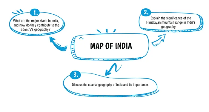
The Himalayas, the world's highest mountain range, serve as India's northern border. They play a crucial role in shaping the climate, acting as a barrier to cold winds from Central Asia. The rivers originating in the Himalayas, such as the Ganges and Brahmaputra, are a major source of water for the plains below. Additionally, the Himalayas are culturally significant, influencing art, mythology, and religious practices.

Q 5. Discuss the coastal geography of India and its importance.

Explanation:

India has a vast coastline along the Arabian Sea to the west, the Bay of Bengal to the east, and the Indian Ocean to the south. The coastal regions are economically significant, with thriving industries, ports, and fisheries. The Western Ghats and Eastern Ghats influence the coastal climate, contributing to the biodiversity of these regions. The coastal areas also play a crucial role in trade and cultural exchange.

ICSE Class 10 Geography Chapter wise Important Questions

Conclusion

If you are looking to further practice and enhance your understanding of the concepts discussed in the chapter, oswal.io provides a comprehensive set of icse class 10 important questions of Map of India for understanding the concept in a better way.

Frequently Asked Questions

Ans: The map features prominent physical features such as the Himalayan mountain range, the Gangetic Plains, the Thar Desert, the Deccan Plateau, and major rivers like the Ganges and Brahmaputra.
Ans: The political map delineates the states and union territories of India, reflecting its federal structure. Each state has distinct boundaries, contributing to the overall administrative organisation of the country.
Ans: The Himalayas are highlighted on the map as a defining geographical feature. They influence India’s climate, house the sources of major rivers, and act as a natural barrier to cold winds from Central Asia.
Ans: The map illustrates the varied climatic regions of India, ranging from tropical in the south to temperate in the Himalayas. It provides a visual representation of the country’s diverse weather patterns.
Ans: Major cities such as New Delhi, Mumbai, Kolkata, and Chennai are marked, representing urban centres significant for economic, cultural, and administrative activities.