Location, Extent and Physical features

Home / Board / ICSE / important Questions / Class 10 / Geography / Location, Extent and Physical features

Class 10 Geography Chapter 3
Location, Extent and Physical features
Important Questions

Here are some class 10 Location, Extent and Physical features important questions and answers.These questions aim to aid students in practising and achieving high scores in their ICSE class 10 geography Examination 2024-25. ICSE class 10 geography important questions will be helpful in scoring good marks and enhance the preparation for the exam. Regular practice with questions helps students become familiar with the structure and format of the exam. By practising class 10 Location, Extent and Physical features important questions and answers students can identify areas where they are struggling. This allows them to focus on these weak points, seeking additional help if needed, and improving overall performance.

Introduction

Class 10’s chapter on India’s geography covers its unique location, spanning from the Himalayas in the north to Kerala’s greenery in the south, Rajasthan’s deserts in the west to West Bengal’s deltas in the east. It explores India’s strategic significance within the Eurasian landmass, detailing its historical impact on trade, culture, and politics. The chapter emphasizes India’s vast extent, discussing how its position influences diverse climates, flora, fauna, and human activities. It extensively examines the Himalayas, Indo-Gangetic Plains, Thar Desert, central highlands, coastal plains, and island territories, highlighting their formation, characteristics, and roles in shaping India’s climate, agriculture, biodiversity, and settlements. These topics are important while studying class 10 Location, Extent and Physical features important questions and answers.

What are Location, Extent and Physical features?

In ICSE X Geography, “Location, Extent, and Physical Features” refer to fundamental elements outlining India’s geographical identity. “Location” signifies India’s coordinates on the world map, spanning from the Himalayas in the north to Kerala in the south, and from Rajasthan in the west to West Bengal in the east. “Extent” emphasizes India’s geographical spread, crucial in understanding its diverse climates, ecosystems, and human activities across latitudes and longitudes. “Physical features” encompass the varied landscapes. By practising class 10 Location, Extent and Physical features important questions and answers students can enhance their preparation.
geography class 10 icse syllabus 2023

Class 10 Location, Extent and Physical features Important Questions and Answers

Q 1. Which line of latitude mainly passes through the middle of India?
Options
A) Equator
B) Tropic of Cancer
C) Tropic of Capricorn
D) Arctic Circle

Ans. B) Tropic of Cancer
Explanation:
The Tropic of Cancer (23°30'N) passes almost through the middle of India, significantly influencing its climate and agricultural patterns.

Q 2. Which of the following mountain ranges form the northern boundary of India?
Options
A) Aravalli
B) Vindhya
C) Satpura
D) Himalayas

Ans. D) Himalayas
Explanation:
The Himalayan mountain ranges form the northern frontier of India, serving as a natural barrier and influencing the climate and ecology of the region.

Q 3. Describe the geographical location and extent of India.

Explanation:
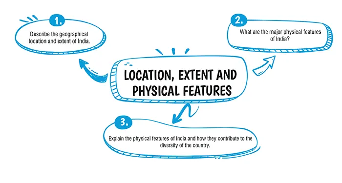
India is located in the southern part of Asia, extending from latitudes 8°4'N to 37°6'N and longitudes 68°7'E to 97°25'E. It's spread over an area of about 3.28 million sq km, making it the seventh-largest country in the world. India shares its land borders with Pakistan, China, Nepal, Bhutan, Bangladesh, and Myanmar, and is surrounded by the Indian Ocean on the south, the Arabian Sea on the west, and the Bay of Bengal on the east.

Q 4. What are the major physical features of India?

Explanation:

India's physical features are diverse and rich, comprising the Himalayas in the north, the Northern Plains, the Indian Desert, the Peninsular Plateau, the Coastal Plains, and the Islands. The Himalayas, a vast mountain range, acts as a natural barrier and influences the climate of India. The Northern Plains, formed by the rivers Indus, Ganges, and Brahmaputra, are known for their fertile lands. The Peninsular Plateau is a region of stable landmass characterised by undulating terrain, rich mineral resources, and a variety of flora and fauna.

Q 5. Explain the physical features of India and how they contribute to the diversity of the country.

Explanation:

India's physical features are diverse and can be broadly categorised into the following:

  • The Himalayas: These are the northern mountain ranges of India, providing a natural barrier and influencing the climate. They are a source of major rivers and foster a unique biodiversity.
  • The Northern Plains: Formed by the alluvial deposits of the Indus, Ganga, and Brahmaputra rivers, these plains are agriculturally fertile and densely populated.
  • The Peninsular Plateau: This is a region of stable landmass characterised by rolling hills and wide valleys. Rich in minerals, it forms the foundation of India's mineral wealth.
  • The Coastal Plains: Running along the Arabian Sea and the Bay of Bengal, these plains facilitate maritime trade and are known for their beaches and fertile land.
  • The Thar Desert: Located in the western part of India, it affects the local climate and is characterised by sand dunes and sparse vegetation.
  • The Eastern and Western Ghats: These are mountain ranges that run along the eastern and western edges of the peninsula, home to diverse flora and fauna.

These physical features contribute to India's climatic, ecological, and cultural diversity. The variation in terrain and climate across the country supports a wide range of agricultural activities, ecosystems, and lifestyles, making India one of the most diverse nations in the world.

ICSE Class 10 Geography Chapter wise Important Questions

Conclusion

If you are looking to further practice and enhance your understanding of the concepts discussed in the chapter, oswal.io provides a comprehensive set of icse class 10 important questions of Location, Extent and Physical features for understanding the concept in a better way.

Frequently Asked Questions

Ans: India is located in South Asia, between latitudes 8°4’N to 37°6’N and longitudes 68°7’E to 97°25’E. It shares borders with Pakistan, China, Nepal, Bhutan, Bangladesh, and Myanmar and is bounded by the Indian Ocean on the south.
Ans: The mainland of India extends from Kashmir in the north to Kanyakumari in the south and from Arunachal Pradesh in the east to Gujarat in the west. Its north-south extent is about 3,214 kilometres, and the east-west extent is approximately 2,933 kilometres.
Ans: India’s major physical features include:
  • The Himalayas: A vast mountain range in the north, acting as a natural barrier. The
  • Northern Plains: Fertile plains formed by the river systems of the Indus, Ganges, and Brahmaputra.
  • The Indian Desert: Located in the western part of India, mainly in Rajasthan.
  • The Peninsular Plateau: A tableland in South India, rich in minerals.
  • The Coastal Plains: Stretching along the east and west coasts of India.
  • The Islands: Including the Andaman & Nicobar Islands in the Bay of Bengal and Lakshadweep in the Arabian Sea.
Ans: The Himalayas play a crucial role in determining the climate of India by acting as a barrier to the cold winds flowing from Central Asia. This ensures milder winters in the northern part of the Indian subcontinent. They also trap the monsoon winds, causing them to shed their moisture within the subcontinent, which is vital for India’s agriculture.
Ans: The Northern Plains of India are significant due to their fertile alluvial soil, which makes them one of the world’s most intensively farmed areas. The plains support a large population and are crucial for agriculture, supporting major crops like wheat, rice, sugarcane, and others.